Avac E-commerce
Stores E-Commerce Application
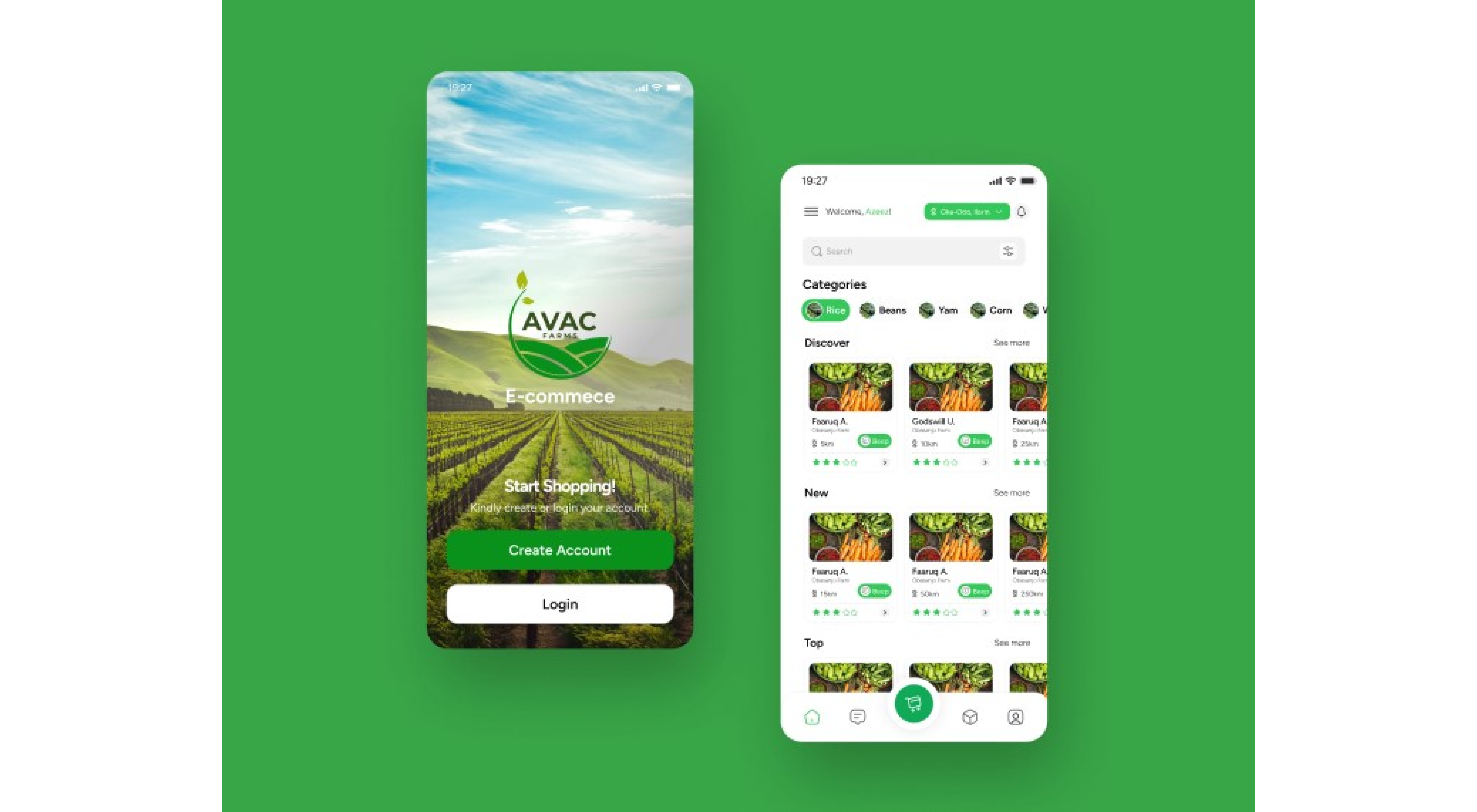
ABOUT AVAC
AVAC is a comprehensive digital platform designed to empower agronomists, farmers, and agricultural associations to optimize crop management, enhance productivity, and improve decision-making.
It offers a user-friendly interface, seamless data management, precise mapping capabilities, and timely notifications to streamline various agricultural tasks.
CHALLENGES
1. Complex Data Management:
Traditional methods of managing farm data, such as paper records and spreadsheets, are often time-consuming, prone to errors, and lack accessibility for collaboration.
2. Inefficient Farmland Mapping:
Accurately delineating farmland boundaries and visualizing spatial data can be challenging with manual methods, leading to potential disputes and challenges in resource allocation.
3.Delayed and Inconsistent Communication:
Timely reminders and notifications regarding critical crop stages and activities are crucial for optimal farm management, but traditional communication methods often lack consistency and reach.
4 Limited Data-Driven Insights:
Analyzing and acting upon farm data to make informed decisions and improve practices can be difficult without tools that effectively visualize and interpret the information.
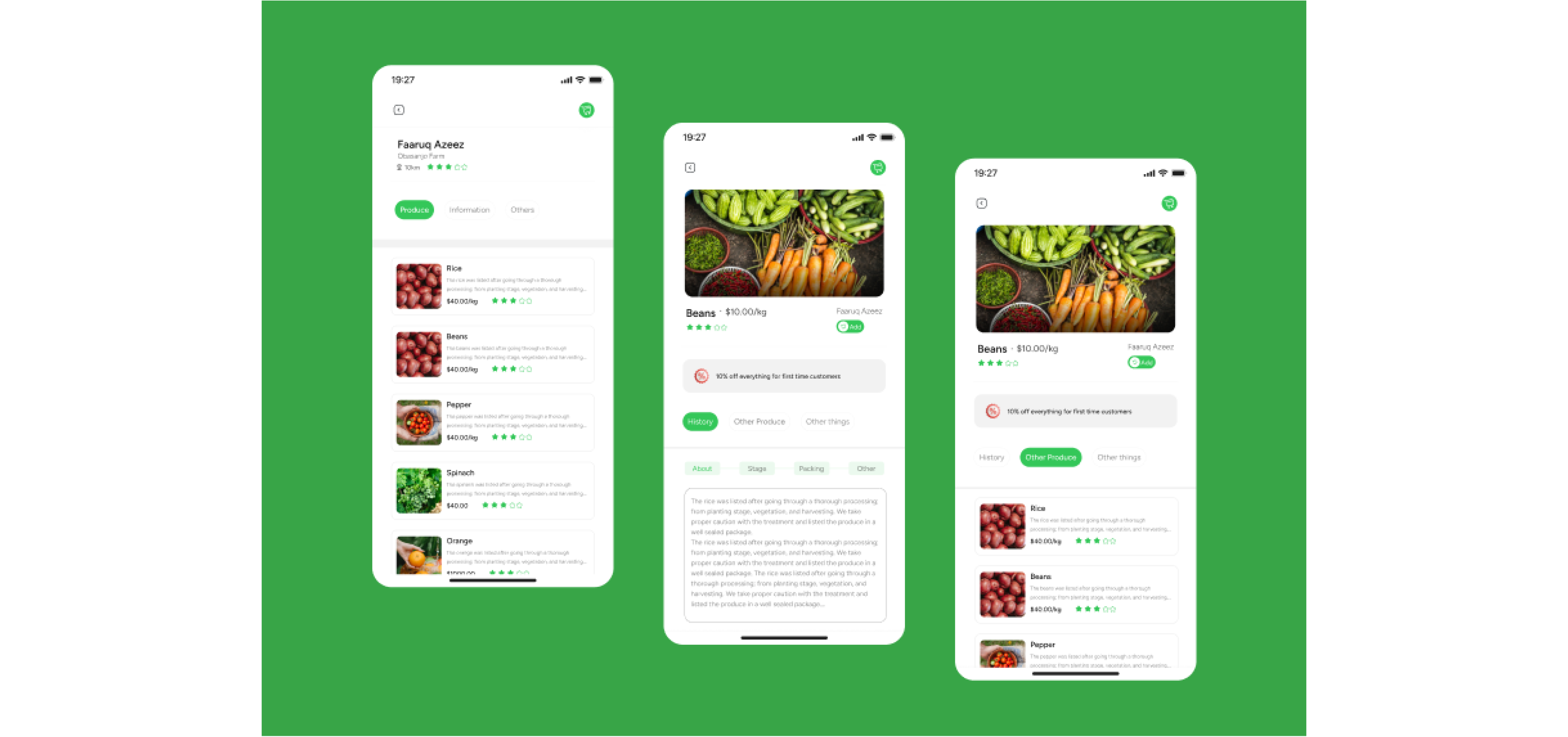
SOLUTION & FEATURES
AVAC addresses these challenges with the following key features:
Secure Authentication: Protects sensitive farm data with role-based access control for agronomists, farmers, and administrators.
Centralized Data Management:Organizes and stores farm, farmer, plant, association, and activity data in a centralized database for easy access and analysis.
Comprehensive Activity Management:Allows agronomists to create, track, and manage activities associated with individual farmlands, improving workflow and productivity.
Interactive Mapping:Enables users to accurately map farmland boundaries using a multipolygon mapping tool, enhancing visualization and spatial analysis.
Phenology Tracking:Facilitates the recording and monitoring of crop growth stages, enabling data-driven decision-making and timely interventions.
Plant-Level Data Collection:Enables recording of detailed information about individual plants, including crop type, phenology stage, genome (integration details pending), local name, classification, planting date, and record date.
Integration with QGIS and Google Earth Enginec:Connects with QGIS for database access and shapefile conversion, and leverages Google Earth Engine for advanced spatial analysis capabilities.
RESULT
Potential, based on expected outcomes.
Increased Productivity:Streamlined data management and communication lead to more efficient farm operations and potential yield improvements.
Improved Decision-Making:Data-driven insights from AVAC empower agronomists and farmers to make more informed decisions about crop management, resource allocation, and pest control.
Enhanced Collaboration:Centralized data and communication tools foster better collaboration between agronomists, farmers, and agricultural associations.
Reduced Costs:Optimized resource allocation and timely interventions can potentially reduce input costs and minimize losses.
Strengthened Farmer Engagement: Timely notifications and user-friendly tools increase farmer engagement in best practices, leading to better outcomes.
Environmental Sustainability:Improved farm management practices can contribute to sustainable agriculture and environmental protection.
OUTCOME
AVAC demonstrates the potential of digital technology to transform the agricultural sector, empowering stakeholders with data, insights, and enhanced communication for more efficient, sustainable, and productive farming practices.